Hurricane Polo forecast: Baja California Sur warning areas and timing
NHC’s latest Hurricane Polo advisory keeps warning, watch and tropical-storm zones on Baja California Sur’s coasts ahead of Monday risks.
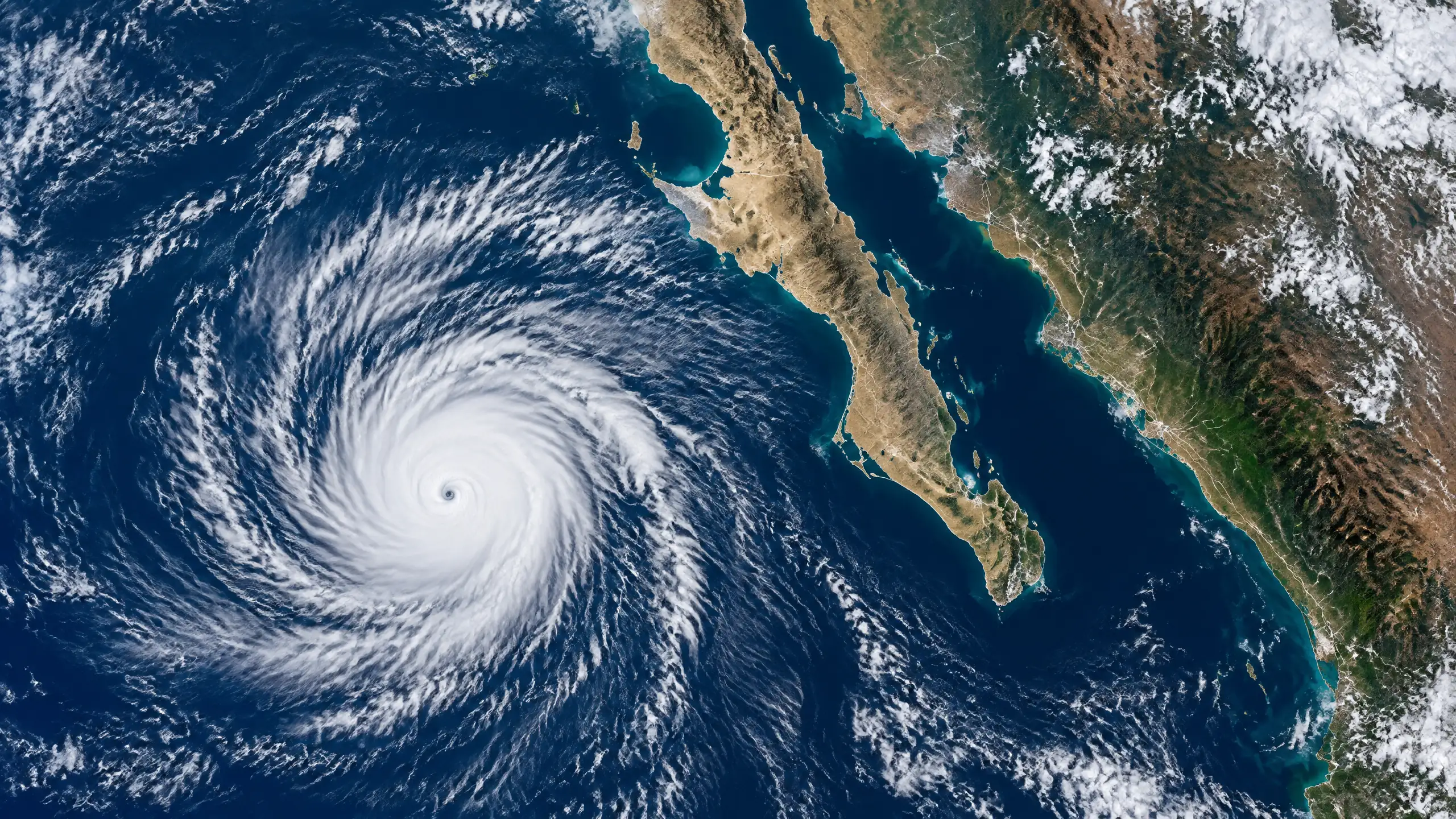
- NHC’s newest available public update at writing time was Intermediate Advisory 26A, issued at 0600 UTC on 27 September 2026.
- A Hurricane Warning covers Baja California Sur’s west coast from Punta Abreojos to Santa Fe; separate watch and tropical-storm warning areas remain in effect.
- At the advisory time, Polo was a Category 3 hurricane about 310 miles (500 km) southwest of Cabo San Lucas; that is an observed position, not a landfall report.
- NHC forecasts hurricane conditions in the warning area by Monday afternoon, with rain totals of 4–8 inches and isolated maxima of 10 inches in parts of Baja California Sur.
- Forecasts and official warning boundaries can change. Mexican local authorities control evacuation, shelter, road and emergency instructions.
Hurricane Polo forecast: the direct answer
Hurricane Polo remains offshore, but the National Hurricane Center (NHC) has a Hurricane Warning in effect for part of Baja California Sur’s west coast. The newest NHC public update available when this draft was checked—Intermediate Advisory 26A, issued at 0600 UTC on Sunday 27 September (labelled 11:00 p.m. MST Saturday by NHC)—said Polo was a Category 3 hurricane with maximum sustained winds near 120 mph (195 km/h). Its centre was near 19.8°N, 113.4°W, about 310 miles (500 km) southwest of Cabo San Lucas. Those are observed advisory-time facts, not a report that the centre had reached land.
The NHC forecast calls for Polo to turn north on Sunday and northeast on Monday, approach Baja California Sur’s west coast on Monday, cross the peninsula Monday night and then approach north-western mainland Mexico early Tuesday. That is the current forecast track, not a guaranteed route or a confirmed landfall location. A forecast can shift with each advisory, including the timing and extent of damaging winds, rain and coastal effects.
For residents, visitors and transport operators, the immediate issue is not the storm’s earlier peak strength but the specific warning zone and the official instructions for the place they are in. NHC says preparations to protect life and property in Baja California Sur should be rushed to completion. For emergency decisions, including shelters, evacuations, road closures and port restrictions, follow Mexican civil-protection authorities and local officials; they control the local advice.
Baja California Sur warning areas: what is in effect
The Hurricane Warning covers the west coast of Baja California Sur from Punta Abreojos to Santa Fe. In NHC terminology, that means hurricane conditions are expected somewhere in the warning area. NHC says hurricane conditions are expected there by Monday afternoon. Tropical-storm conditions could begin in the southern part of that warning area from Sunday night into early Monday, then spread north during Monday and east across Baja California Sur by Monday evening.
The same advisory lists two Hurricane Watch areas: the west coast north of Punta Abreojos to Punta Eugenia, and the east coast from Bahía San Juan Bautista to San Evaristo. A watch means hurricane conditions are possible, rather than expected, within the listed area. A Tropical Storm Warning is also in effect on the west coast north of Punta Abreojos to Punta Eugenia, where tropical-storm conditions are expected. These boundaries are not a statement that every community inside them will experience identical wind or rain; local terrain and the eventual track matter.
The labels are practical planning tools, not a hurricane-impact ranking. NHC generally uses a hurricane warning when tropical-storm-force winds are anticipated within 36 hours, making outdoor preparation difficult or dangerous; a hurricane watch is generally used when such conditions are possible within 48 hours. People outside a warning polygon should not treat that as an all-clear, especially near beaches, arroyos, steep slopes or routes that local authorities flag as vulnerable.
Timing: forecast arrival, not completed impact
As of the 0600 UTC advisory, Polo was moving northwest near 10 mph (17 km/h). The NHC forecast advisory issued three hours earlier projected maximum winds of 90 knots (about 104 mph) near 24.2°N, 113.7°W at 1200 UTC on 28 September, and 80 knots near 25.8°N, 112.5°W at 0000 UTC on 29 September. Those forecast points indicate an expected weakening trend while still keeping Polo at hurricane strength near Baja California Sur. They are not observations and should not be presented as a final intensity at any town.
The appropriate wording remains “forecast to approach” and “conditions expected” rather than “has made landfall.” NHC’s public advisory does not report a Baja California Sur landfall at this stage. It forecasts the system moving across the peninsula on Monday night; readers should wait for a later official advisory or Mexican authority update before treating any crossing, landfall, closure or damage as completed.
The forecast also does not establish a safe time for travel between the listed endpoints. Wind and rain may arrive well before the closest approach of the centre, and conditions can deteriorate on exposed coastlines or in higher terrain. Check an airline, ferry, road operator or accommodation provider directly, and do not drive through water or around a closure. The U.S. Embassy’s Mexico weather alert similarly advises travellers to check road and flight conditions and follow local directions.
Rain, surf and flooding risk: what is forecast
NHC forecasts 4 to 8 inches (about 100 to 200 mm) of rain across portions of Baja California Sur, with isolated maxima of 10 inches (about 250 mm). It says that rainfall may cause life-threatening flooding and mudslides, particularly in steep terrain. “May” is material: the figures are forecast totals for parts of the state, not measured rainfall and not a promise that each location will receive the same amount.
On the coast, the advisory says a storm surge could cause significant flooding where onshore winds occur, accompanied by large and destructive waves. Swells generated by Polo are expected to affect Baja California Sur during the next couple of days and spread north along the peninsula through the rest of the weekend. NHC warns that surf, rip currents and coastal flooding may be life-threatening. Keep out of the water and away from beaches, jetties and wave-washed roads where local officials or lifeguards advise it; surf danger can precede the centre’s closest approach.
The storm’s current wind field is already extensive: NHC placed hurricane-force winds up to 40 miles (65 km) from the centre and tropical-storm-force winds up to 150 miles (260 km) from it at the 0600 UTC update. That measurement describes the storm at that time offshore. It does not map the future wind exposure of a particular settlement, so the current official local forecast remains more useful for a street-level decision.
What earlier reporting adds—and what it cannot confirm now
Independent reporting shows why the storm has drawn close attention, but its older numbers should not replace the newest advisory. CBS News updated its report late on 26 September with Polo’s Category 3 status, the Baja California Sur warning areas and the NHC rainfall and surf outlook. The Guardian’s 25 September weather analysis also documented Polo’s exceptional earlier intensity. Both accounts support the broader picture of a powerful, evolving Pacific cyclone; neither should be used as a current warning map for 27 September.
NASA’s Earth Observatory separately documented the storm’s rapid intensification over unusually warm waters earlier in the week, based on satellite and related data. That explains how Polo became unusually intense, but it does not change the present operational question: conditions in Baja California Sur will be determined by the next track, intensity and local-warning updates. The NHC’s 27 September advisory is the source for the warning areas and projected timing in this article.
This distinction matters because a storm can weaken and still bring hazardous rain, surf and flooding. Conversely, a category number alone does not say which road, beach or neighbourhood faces the greatest immediate threat. Treat historic peak-intensity coverage as context, and check authoritative local notices for live impacts.
Practical checks for residents and travellers
Start with your exact location: determine whether it is inside the Hurricane Warning, Hurricane Watch or Tropical Storm Warning listed above, then check an updated Mexican National Meteorological Service bulletin and Baja California Sur Civil Protection notice. Keep phones charged, preserve essential documents and medicines, and make a plan for household members and pets. If an authority tells people to leave, use the stated route and timing rather than waiting to assess conditions independently.
Avoid coastline viewing, swimming and boating as conditions worsen. Floodwater can conceal washouts and become dangerous quickly; never cross a barricade or drive through water. In mountainous or steep areas, watch for local mudslide, road and drainage guidance. The U.S. Embassy alert advises people to monitor local media, check roads before travel and contact airlines for flight updates; those are sensible checks, but they do not replace directions issued by Mexican authorities.
Visitors should tell a trusted contact where they are staying, retain multiple ways to receive official alerts and ask accommodation staff about their emergency plan. Do not rely on a single social-media post or a static forecast image. The NHC explicitly says people should monitor their national meteorological service for location-specific storm information, and its next complete advisory is scheduled after the intermediate update.
What to monitor next
The next NHC advisories may revise Polo’s centre, strength, forward speed, rain outlook or warning boundaries. The forecast advisory notes that average track errors grow with time, which is why the Monday and Tuesday depiction should be used for preparation rather than as a precise point forecast. A forecast change is not evidence that earlier preparation was unnecessary; it is the normal reason to keep checking the official feed.
For broader context on reading a time-bounded weather alert, see our Gujarat rain warning guide, which explains why a warning is not proof that every place has already been hit, and Reading the monsoon for a wider weather-literacy explainer. Readers interested in resilience and water-management planning can also read India International Water Week’s 2026 agenda. Those pieces cover different regions and dates and are not substitutes for the latest Baja California Sur emergency instructions.
Reader guide
Article questions, answered
Short answers to common reader questions based on the reporting above.
Which parts of Baja California Sur are under a Hurricane Warning for Polo?
NHC’s Intermediate Advisory 26A, issued at 0600 UTC on 27 September, lists the west coast from Punta Abreojos to Santa Fe. The boundary can change, so check the newest NHC and Mexican civil-protection updates before acting.
Has Hurricane Polo made landfall in Baja California Sur?
Not in the newest NHC advisory used for this draft. At 0600 UTC, its centre was still about 310 miles (500 km) southwest of Cabo San Lucas. NHC forecast an approach to the west coast on Monday and a move across the peninsula Monday night; that was a forecast, not a completed landfall report.
When are hurricane conditions expected in the warning area?
NHC says hurricane conditions are expected by Monday afternoon along the warned west coast. Tropical-storm conditions are possible in the southern portion from Sunday night into early Monday. The timing may change with later advisories.
What rain and coastal hazards are forecast from Hurricane Polo?
NHC forecasts 4–8 inches of rain, with isolated 10-inch totals, in parts of Baja California Sur. It also warns of possible coastal flooding from surge, large waves, dangerous surf and rip currents. These are forecast hazards, not confirmed conditions at every location.
Sources and further reading
These references support the factual context used in this article. Links open the original publisher.
- Hurricane Polo Intermediate Advisory Number 26A, 0600 UTC, 27 September 2026NOAA National Hurricane Center · accessed 27 September 2026, 06:15 UTC
- Hurricane Polo Forecast/Advisory Number 26, 0300 UTC, 27 September 2026NOAA National Hurricane Center · accessed 27 September 2026, 06:15 UTC
- Weather Alert: Hurricane Polo Update – Baja Peninsula and Sonora in Storm’s PathU.S. Embassy & Consulates in Mexico · accessed 27 September 2026
- Hurricane Polo swirls off Mexico's Pacific coast as a major Category 3 stormCBS News · accessed 27 September 2026
- Hurricane Polo barrels towards Baja California region of MexicoThe Guardian · accessed 27 September 2026
- Explosive Intensification for Hurricane PoloNASA Earth Observatory · accessed 27 September 2026